The CaD Studio

The Climate-adaptive Design (CaD) Studio is an academic course that links Cornell University landscape architecture students with Hudson River Estuary municipalities to explore design alternatives for more climate-resilient communities. CaD is grounded in the idea that by working with both people and place, we can build physical, ecological, and community capacity to adapt to change. 

From 2015 to 2022, the CaD Studio focused on adapting Hudson River waterfronts to flooding from heavy precipitation and sea level rise. After a pause, the studio returned in 2026, with an expanded scope that includes extreme heat, ecological resilience, flooding, and stormwater management. More than 100 students have gained valuable real-world experience through the CaD studio, which is led by Joshua F. Cerra at the Cornell Department of Landscape Architecture. 

Explore our publications to learn more about the CaD studio:  

CaD Host Communities

CaD host communities invest in the studio by participating in a process that focuses on the impacts of climate change, and starts conversations about the importance of adaptation. In exchange, the communities receive multiple design strategies for more beautiful, connected, and resilient study areas. 

During the four-month design process, student teams study the community, conduct field visits, and meet with stakeholders. Students infuse their designs with details that they learn from their interactions with stakeholders. In addition to adaptation strategies, designs include ideas for improving circulation of pedestrian and automotive traffic, addressing way-finding for visitors, and identifying landscape enhancements that improve quality of life for people and wildlife. 

To date, the CaD Studio has been held in eight host communities - cities, towns and villages located on different sections of the Hudson River Estuary. Although each host community is unique, the studio has identified common themes among them - to enhance connections between downtown and waterfront areas, to reduce flood risk, and to use natural and nature-based solutions to mitigate stormwater runoff and the urban heat island effect. 

After the studio semester ends, host communities receive educational materials featuring student designs to inspire continued climate adaptation conversations. They also receive support from the Hudson River Estuary Program to address adaptation actions and advance select design ideas towards implementation. 

Educational materials from the Tarrytown CaD Studio featuring student designs:

Village of Tarrytown

The 2022 design team was comprised of 15 graduate and two undergraduate students. This design studio investigated climate-associated flood and inundation risks in Tarrytown, a village of with a population of 11,700, located on the east side of the Hudson in Westchester County in the lower Hudson Valley. The CaD study area focused on the waterfront, which includes parks, a marina and boat club, as well as the downtown district with businesses, residences, municipal buildings and the train station. Student design concepts ranged from naturalized shorelines and wetland restoration to elevating infrastructure and strategic relocation of key services out of flood-prone areas.  

Educational materials from the Poughkeepsie CaD Studio featuring student designs:

City of Poughkeepsie

The 2021 design team combined 10 third-year graduate and 4 senior undergraduate students. The studio investigated climate-associated flood and inundation risks in Poughkeepsie, a city with a population of around 32,000 people, located on the east side of the river in Dutchess County in the mid-Hudson Valley. The studio focused on Poughkeepsie’s popular waterfront, including Waryas and Kaal Rock parks, and the Southern Waterfront brownfield re-development site. Student proposals included re-grading parts of the waterfront parks to maintain access as sea level rises, wetland restoration, elevating the existing rail line, and enhancing connections between the waterfront and the city center.

Educational materials from the Ossining CaD Studio featuring student designs:

Town & Village of Ossining

The Town and Village of Ossining co-hosted this third-year graduate design studio focused on flooding and other climate risks on the Village waterfront. The 2019 design team was comprised of 11 graduate students, who envisioned resilience strategies for this complex waterfront area that includes parks, housing, businesses, a marina, an oil transfer facility, train station, parking lots, county wastewater treatment plant, and a state correctional facility. The proposed design concepts explored developing a buffer zone, elevating the rail line, inspiring citizen science, facilitating marsh migration and land contouring, and enhancing access to the Ossining waterfront.

Educational materials from the Poughkeepsie CaD Studio featuring student designs:

City of Kingston 


The City of Kingston, population 23,748, is located on the west side of the river in Ulster County in the mid-Hudson Valley. Kingston hosted three different Climate-adaptive Design studios. In 2016, students developed design concepts for the Block Park area, located on the tidal portion of the Rondout Creek. In 2017, the studio focused on Kingston Point Park, located at the confluence of the Rondout Creek and the Hudson River. In 2018, the studio focused on the East Strand neighborhood along the Rondout. Design strategies addressed a range of interests including floodable open space, marsh migration, nature-based shoreline interventions, community features, and development interests while seeking to link interventions to the ongoing growth of Kingston’s waterfront.

Educational materials from the Piermont CaD Studio featuring student designs:
 

Village of Piermont

The Village of Piermont hosted the 2017 studio, with a design team of fourth year, first-semester undergraduate students. Piermont, with a population of around 2,600 people, is located on the west shore of the Hudson in Rockland County, 25 miles north of New York City. The studio focused on the Piermont waterfront, which is situated at the confluence of the Hudson and the Sparkill Creek. The waterfront includes residences, businesses, municipal buildings, a marina, the Piermont Pier, and the Piermont Marsh. Student designs generated strategies that combined adaptation, reinforcement, and relocation approaches.

City of Hudson

The City of Hudson, population 5,600, is located on the east shore of the river in Columbia County. Located well inland from the mouth of the Hudson River as it exits into the Atlantic, the city was once a strategic port for America's whaling industry. The design team of second year, second-semester graduate students focused on the waterfront area, which includes a park, boat launch, parking lots, train station, aggregate shipping facility, and historic buildings. The proposals generated options for floodable retrofit of historic buildings, floodable park spaces, maintenance of the rail connection to NYC, and assisted marsh migration as water levels change.

Village of Catskill

The first Climate-adaptive Design studio studied the Village of Catskill, population 3,679, located on the west shore of the river in Greene County. The studio focused on the downtown area on the tidal portion of the Catskill Creek near its confluence with the Hudson. The 2015 design team of senior undergraduate students developed five alternative design concepts for the downtown Catskill project area. Collectively, the alternative design concepts proposed strategies to reintroduce Catskill's waterfront as a key asset to the Village by enhancing circulation and access between the waterfront and downtown, creating attractive waterfront features, and improving the ecological and recreational value of the shoreline itself.
 

CaD Advancement


Four host communities have advanced projects based on student design concepts and the CaD principles of soliciting stakeholder input to design destinations that are community focused, flood resilient, ecologically vibrant, and adaptive to changing conditions.


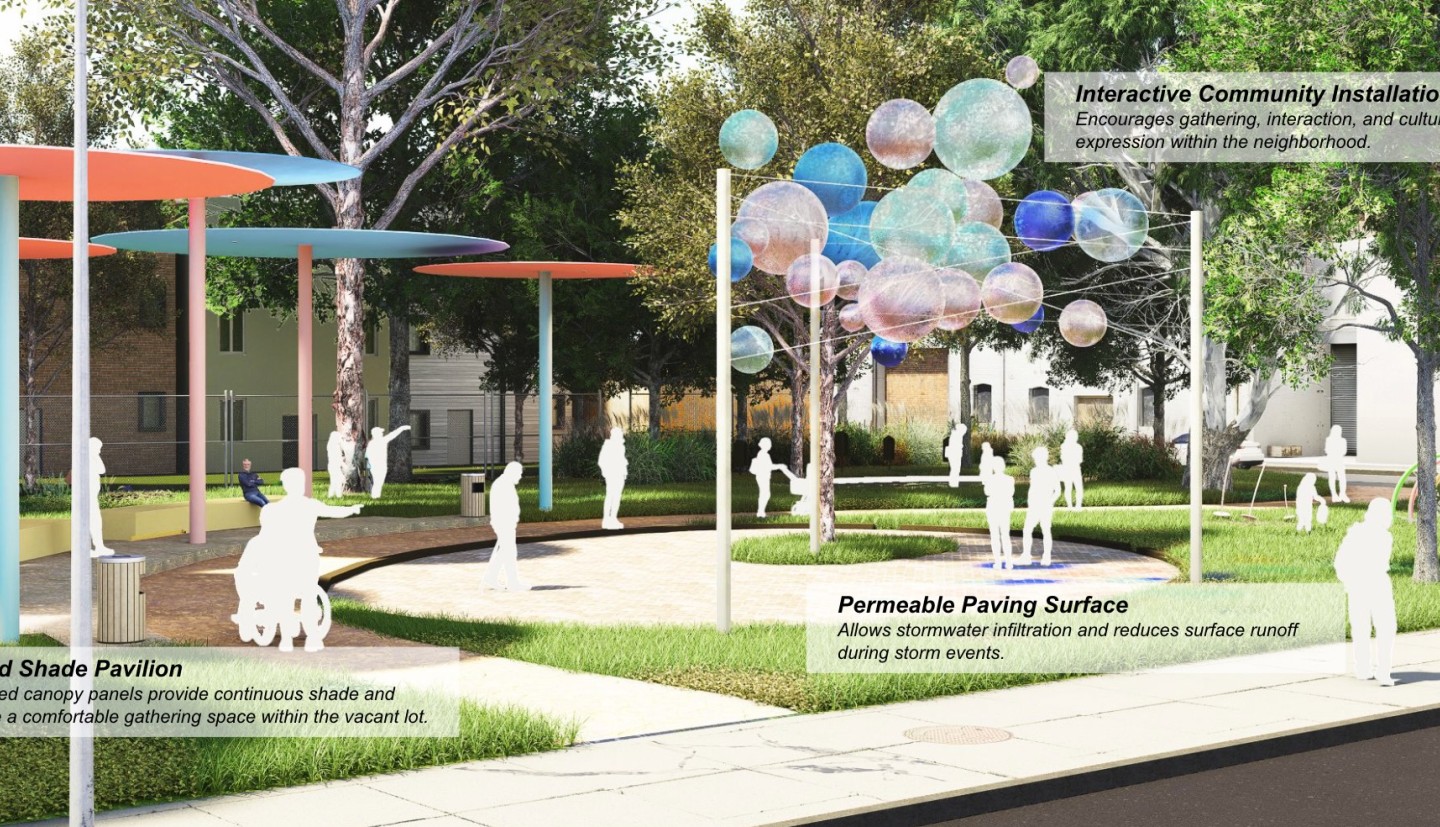
Village of Ossining (2022)


Henningson, Durham and Richardson Architecture and Engineering, P.C. (HDR) was awarded a Hudson River Estuary Program grant to conduct stakeholder engagement, site assessment activities, and the preliminary design for shoreline improvements with cultural/educational amenities that would build upon the concepts and design ideas developed by the CAD Studio students. HDR's Ossining Shoreline Revitalization Project was completed in 2022.  Learn more about the project from the Virtual Open House StoryMap or watch a video of the final project presentation.


City of Hudson's Henry Hudson Riverfront Park (2022)


Hudson Valley Collaborative partnered with the City of Hudson to re-imagine the waterfront at Henry Hudson Riverfront Park, a 7-acre park. The overall vision of the project was to expand the park, prioritize pedestrians, enhance nature, and design for inclusion. The process included an intensive community engagement strategy to create dialogue and receive feedback from the community.  You can read the full report here. In 2024, Assemblage Landscape Architecture was awarded a grant from the Hudson River Estuary Program to advance the Hudson Valley Collaborative design for Henry Hudson Riverfront Park toward implementation.


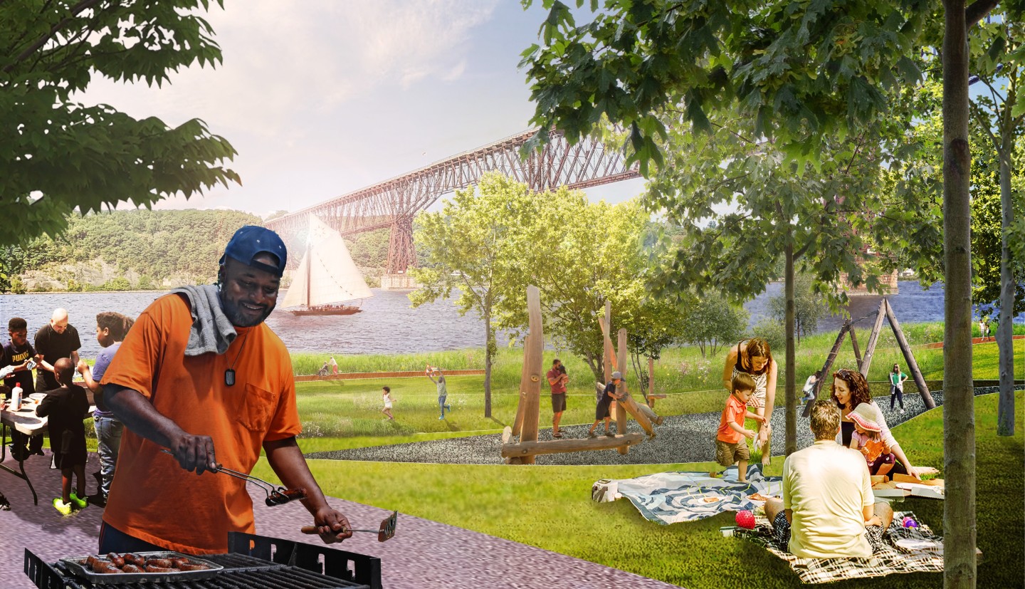
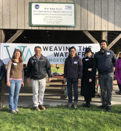
Kingston Point Climate-adaptive Beach with Wetland Cove (2020)


Supermass Studio, along with emphas!s design and EDesign Dynamics, partnered with the City of Kingston to re-imagine the Kingston Point Beach. The overall vision of the project is to create a well connected and resilient Kingston Point which can remain a viable public and natural asset for Kingston for decades to come. Emphas!s design worked with the City of Kingston to "co-brand" their many waterfront projects under Weaving the Waterfront to help communicate a more holistic approach to the public. See the City's outreach and engagement website for this project for more information. In 2024, the City of Kingston was received a NY Swims Award to implement the resilient design for Kingston Point Beach.


Piermont Living Shoreline (2020)


Henningson, Durham and Richardson Architecture and Engineering, P.C. (HDR) partnered with the Village of Piermont to redesign the coastal area just north of the pier near Parelli Park. The completed project design proposes reinforcing the existing submerged rock jetty, providing multiple access points to the river including a beach access for kayaks, vegetated marsh plantings in the intertidal zone, and a gradually sloping revetment planted with native vegetation to help protect the existing shoreline from erosion.

Climate Smart Communities Videos