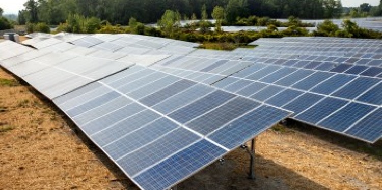
Renewable energy infrastructure is booming globally, driven by improved tech, rising oil prices and global energy instability. But large, utility-scale solar projects often raise community concerns about land-use changes. Researchers have developed a model that overlays areas suitable for solar development with prime farmland and habitats critical for protecting biodiversity in New York. The model could inform solar siting decisions across the state, helping communities identify critical areas to protect.
The study, “Sustainability Trade-offs at the Nexus of Solar Energy, Agriculture and Biodiversity,” published April 22 in Geography and Sustainability. The team of researchers from Cornell, The Nature Conservancy (TNC), the U.S. Geological Survey (USGS) and Central Michigan University assessed the geography of New York state according to three competing land-use priorities: solar development at the lowest cost, farmland preservation and biodiversity conservation. Their overlapping maps based on those priorities identified potential low-conflict sites and hotspots where competing priorities could lead to tradeoffs of potential solar development.
“There’s land-use conflict associated with solar energy development because there are different people interested in biodiversity, agriculture and energy, but in reality those things are interacting in a nexus,” said Steve Grodsky, the paper’s senior author and assistant professor of natural resources and the environment in the Ashley School of Global Development and the Environment. “We are addressing those things all at once so we can give people a better idea of the interactions and the potential land-use change. This modeling gives us an opportunity to forecast potential interaction points and potential conflict zones, and allows communities and agencies to make more-informed choices in siting decisions.”
The researchers found that prioritizing agriculture spares roughly 80% of potential siting on farmland but increases potential deforestation for solar. Protecting biodiversity by avoiding ecologically sensitive areas increased annualized costs by 0.17% and resulted in more pasture, hay fields and cultivated cropland being converted to solar.
In 2018 New York passed landmark climate-protection legislation that mandated the state obtain 70% of its electricity from renewable sources by 2030 and 100% by 2040. But even in states without climate mandates, projects are surging. For example, South Dakota produces over 80% of its energy from renewables, and big, sunny Texas has added more renewable capacity in the last two years than New York has over the last 20. The researchers chose New York as a case study but their findings can be applicable anywhere that communities are facing solar siting decisions, said Grodsky, who is also assistant unit leader of USGS’ New York Cooperative Fish and Wildlife Research Unit. This work builds on more than a decade of collaboration between Cornell and TNC, facilitated by the Cornell Atkinson Center for Sustainability, and TNC is incorporating the paper’s findings into its nationwide Site Renewables Right tool.
To maximize the usefulness of their model for solar siting considerations, the researchers used the “most aggressive utility-scale solar scenario” from New York State Energy Research and Development Authority’s (NYSERDA) analyses, which assumes that New York would reduce all of its greenhouse gas emissions by over 85% by 2050, said Adam Gallaher, first author on the paper, formerly a postdoctoral associate in Grodsky’s lab and now an assistant professor at Central Michigan University. Under that scenario, the researchers found that New York would need to build roughly 46,000 megawatts of solar energy – a total land area of about 107,700 acres, Gallaher said. For context, New York’s total land area is roughly 30 million acres, including 6.5 million acres of farmland and 4.5 million acres of protected, state-owned land.
“Traditionally, solar siting has been evaluated through a least-cost objective where the primary goal is to site the energy quickly, cost effectively and ensure reliability. But there is a lot of community pushback around wanting to protect prime farmland and concern around clear-cutting forests,” Gallaher said. “What we’ve found is that it is possible, and minimally more expensive, to take into account multiple criteria that can inform just and ecologically responsible energy transitions.”
To assess where solar developers could build at lowest cost, researchers relied on a solar suitability map (previously developed by some of the paper’s co-authors) that takes into account proximity to roads and transmission lines, current land use, soil type and other factors. To assess biodiversity concerns, they used data from TNC’s Resilient and Connected Network and New York Department of Environmental Conservation’s grassland bird conservation centers to assess lands that are not already protected for conservation. Data on New York farmlands comes from the U.S. Department of Agriculture and NYSERDA.
Additional co-authors are Peter Woodbury ’87, MS ‘90, Ph.D. ‘02, senior research associate in the School of Integrative Plant Science’s (SIPS) Soil and Crop Sciences Section; Theodore Koch, a graduate student in soil and crop sciences; and Elizabeth L. Kalies ’98, lead renewable energy scientist for TNC’s North America region.
This research was funded by Cornell Atkinson.
Krisy Gashler is a writer for the College of Agriculture and Life Sciences.