Feuerstein pointed out to his blog readers that the gathering storm likely would run the water gap between Cancun, Mexico and western Cuba, gathering energy in the warm “bathtub” of the Gulf of Mexico – and then quickly charge north to make landfall in Louisiana.
And that’s exactly the storm’s path.
Pressure dropped rapidly in the hurricane. “The floor really came out from under it,” Feuerstein said, explaining that millibars – a unit of pressure – meant the storm was converting oceanic heat into energy.
“That energy is seen in the way that wind rushes toward the very low pressure,” he said. “Much in the same way that a vacuum can pull up debris from the ground because it has a lower pressure inside the vacuum body than the air outside. When the pressure is really low in a hurricane, not only does it draw in air efficiently, it can also pull up water from the ocean.”
On Aug. 26, NOAA’s National Hurricane Center declared the storm a tropical depression in the morning and made it a tropical storm in the afternoon. Ida became a Category 1 hurricane on Aug. 28.
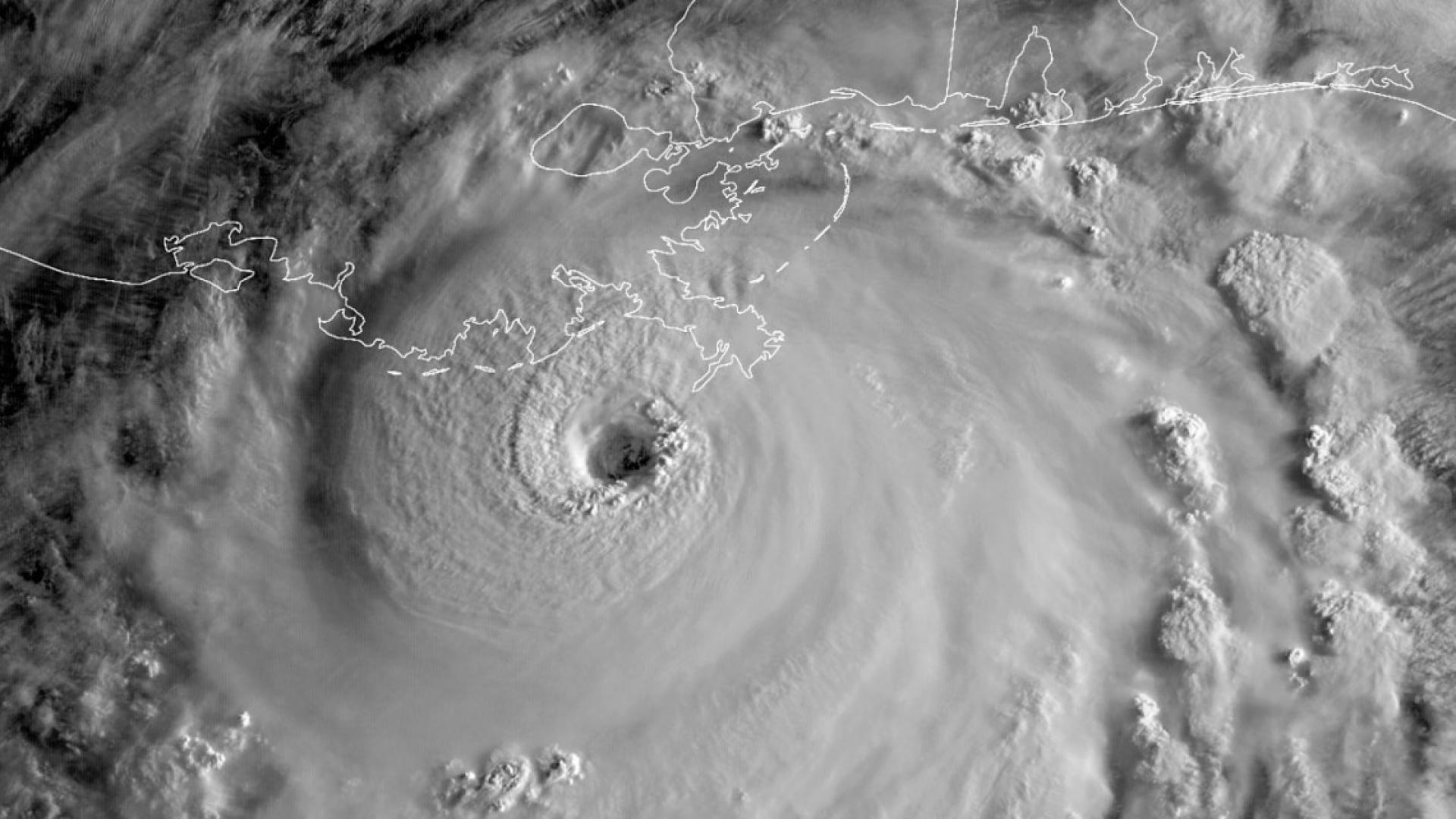
Hurricane Ida jumped to a Category 4 storm overnight on Aug. 29 – sustaining 130 mph to 150 mph winds. The hurricane kept its Category 4 status for about five hours after it reached landfall in Louisiana, soon after noon Central Daylight Time on Aug. 29.
Since he was a child, Feuerstein has been fascinated by the weather and worked through middle school and high school science fairs. Earlier this summer, he helped the Binghamton, New York office of the National Weather Service identify a tornado that touched down in Dryden, New York, on June 21.
Last year Feuerstein was selected for the prestigious 2021 National Oceanic and Atmospheric Administration (NOAA) Ernest F. Hollings Undergraduate Scholarship Program, which provides students with practical experience in research, technology, policy and management. In addition, the program provides financial scholarships and a paid summer internship at NOAA.
Feuerstein is working with his advisor Arthur T. DeGaetano, professor of earth and atmospheric sciences (CALS) and a fellow in the Cornell Atkinson Center for Sustainability, on flash flooding research that they hope to publish late next year.
Beyond landfall, Feuerstein realizes that the hurricane’s remnants will wend their way northeast. Current soil models for the region show over 90% of moisture capacity for land in the region, as the rainy storm is expected to pass through Sept. 1.
Feuerstein worries about the Susquehanna River, the Delaware River and Lehigh Valley basins.
“The Northeast is saturated right now because it has rained so much in the past few months,” he said. “There really isn’t much capacity for additional runoff.”
This story first appeared in the Cornell Chronicle.
Header image: As seen from the GOES-16 satellite, operated jointly by NASA and NOAA, Category 4 Hurricane Ida approaches landfall Aug. 29 in Louisiana, just after sunrise. Photo by NASA/NOAA/Provided